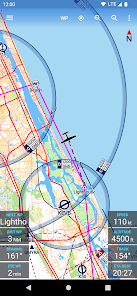
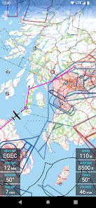
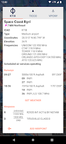
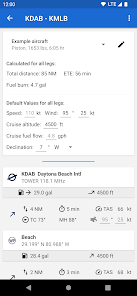
Day by day, the features and capabilities of Android smartphones are increasing thanks to their various programs and they play an effective role in our lives. The huge use and high popularity of Android devices is so much that the developers and creators of the programs allow themselves to sometimes take a step beyond the normal situation and introduce special startups. Avia Maps Aeronautical Charts program is exactly a clear example of this category of applications; The above application developed by Remy Webservices UG and published on Google Play. It is a special aviation map that is a suitable option for pilot enthusiasts! Yes, you heard right! Today, thanks to our Android smartphones, we can not only access normal maps of world cities, but aviation maps have also been introduced for a special category of users. In these maps, you can access the location of more than 50 thousand airports around the world. The airspace of different countries is marked with high accuracy and you will be able to use them endlessly in your calculations in various conditions and according to your needs. The information provided by this program allows you to calculate the flight distance of the plane and determine how much fuel you need for a flawless flight. Currently, the aviation maps of more than 42 different countries are available to you, which is unique compared to similar apps. If you are also interested in accessing the maps at any time, just mark the area you want and get the aviation map of the country you want to experience unlimited access at any time offline. do. One of the things that makes Avia Maps’ calculations very accurate is its support for Avia Weather. All weather information is easily received by meteorological stations and all calculations are calculated and displayed based on weather conditions and atmosphere prevailing on the plane.
Some features and capabilities of the Avia Maps Aeronautical Charts Android program:
Access to aviation maps of more than 42 different countries
Very high detail maps with proprietary markings
Calculate the amount of fuel needed to have a safe flight
Receive information from the Avia Weather service for accurate calculations
Observing the air border of different countries
Get maps to use them offline
Display more than 50 thousand different airports around the world
The reliable and straightforward Aviation Maps for Pilots and aerospace enthusiasts around the world. Simply choose any 5 by 5 degree area on earth and download relevant data for offline use. The map features over 50000 airports and 11000 navaids around the globe, just as airspaces for currently 42 countries on all continents (except Antarctica).
For clarity and commonality to paper charts the map is themed in the style of ICAO Annex 4 (Aeronautical Charts). The app is suited for pre-flight route planning with wind and fuel calculations, as well as in-flight navigation. To get the latest weather for more than 9500 airports it is integrated with Avia Weather.
This is a trial app with full features. After an evaluation period of 30 days you will have to do an in-app purchase of $19.99 (might vary in your currency). There will be no recurring charges.
Countries with Airspace data include the United States and Canada, most of Europe, Australia and New Zealand.
App Specs
- For ANDROID
- Update October 4, 2023
- Version 3.11.4
- Android 5.0
- Developers Remy Webservices UG
- Category Maps & Navigation
- View on Google Play


